Wednesday, cold, cloudy, calm at the French Shore Interpretative Center, Conche, NL.

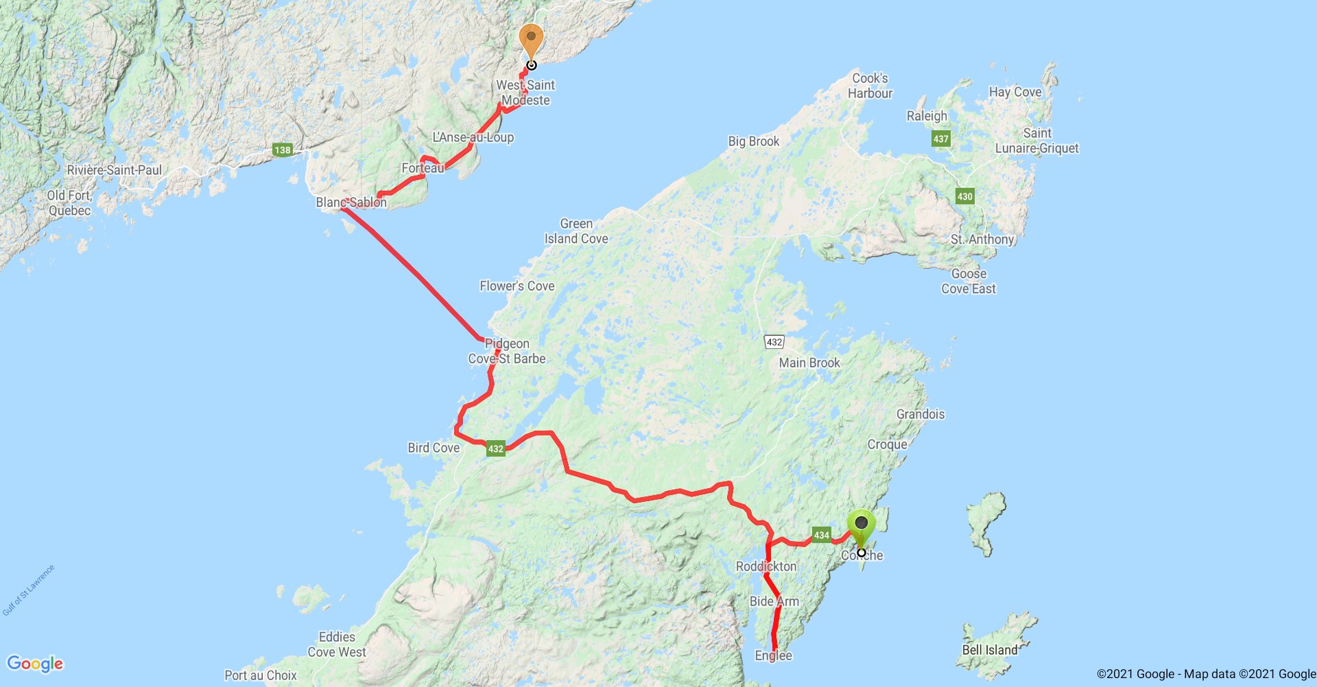
After breakfast, we decided we’d drive on down to the end of this peninsula on the eastern side of the Great Northern Peninsula. So we drove back west along the mostly-gravel road, Rt. 434, to the paved Rt.433 along Canada Bay. We turned south along the bay and eventually along the east side of Bide Arm all the way to Englee at the mouth of the arm and bay. Englee is a typical Newfoundland outport that got its start as a fishing factory on the French Shore.

(Quick recap: very soon after the Europeans “discovered” the “New World” they discovered the very productive “banks” of marine life off the Atlantic coasts. They, especially the French, began seasonally fishing off the coast of Newfoundland using the sheltered shores to process the fish, especially the cod, for shipment back to Europe. The preferred process involved de-heading, gutting, filleting, salting, then sun-drying. The last was best done on shore as were other tasks to maintain the fishing gear, assemble the barrels the fish were shipped back in, etc. Eventually, settlements were developed. Outports are the coastal towns closest to the open waters and the banks of fish. Inports are the coastal towns at the opposite end of the bays and coves where families retreated in the winter for better weather and to hunt, trap, and cut timber. Fishing was never easy work and eventually overfishing depleted the banks until finally Canada declared a moratorium on cod fishing and the industry collapsed.)
As is typical of many Newfoundland outports, Englee struggles to stay relevant and find economic initiatives. One of those initiatives is tourism. In addition to beautiful scenery, many of towns have developed trails and heritage sites, which preserve significant buildings and tell the history of the town. Those towns lucky enough to be on the iceberg routes from Labrador, or the migratory routes of marine mammals and sea birds, emphasize those.
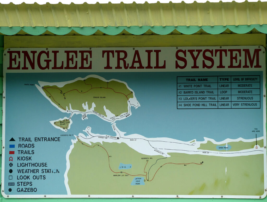
Englee has the beautiful scenery, the potential of seeing icebergs and whales, and several trails. Hanson took the trail up Barr’d Island at the end of town, 165 steps to the top of the hill for a spectacular 360° view.
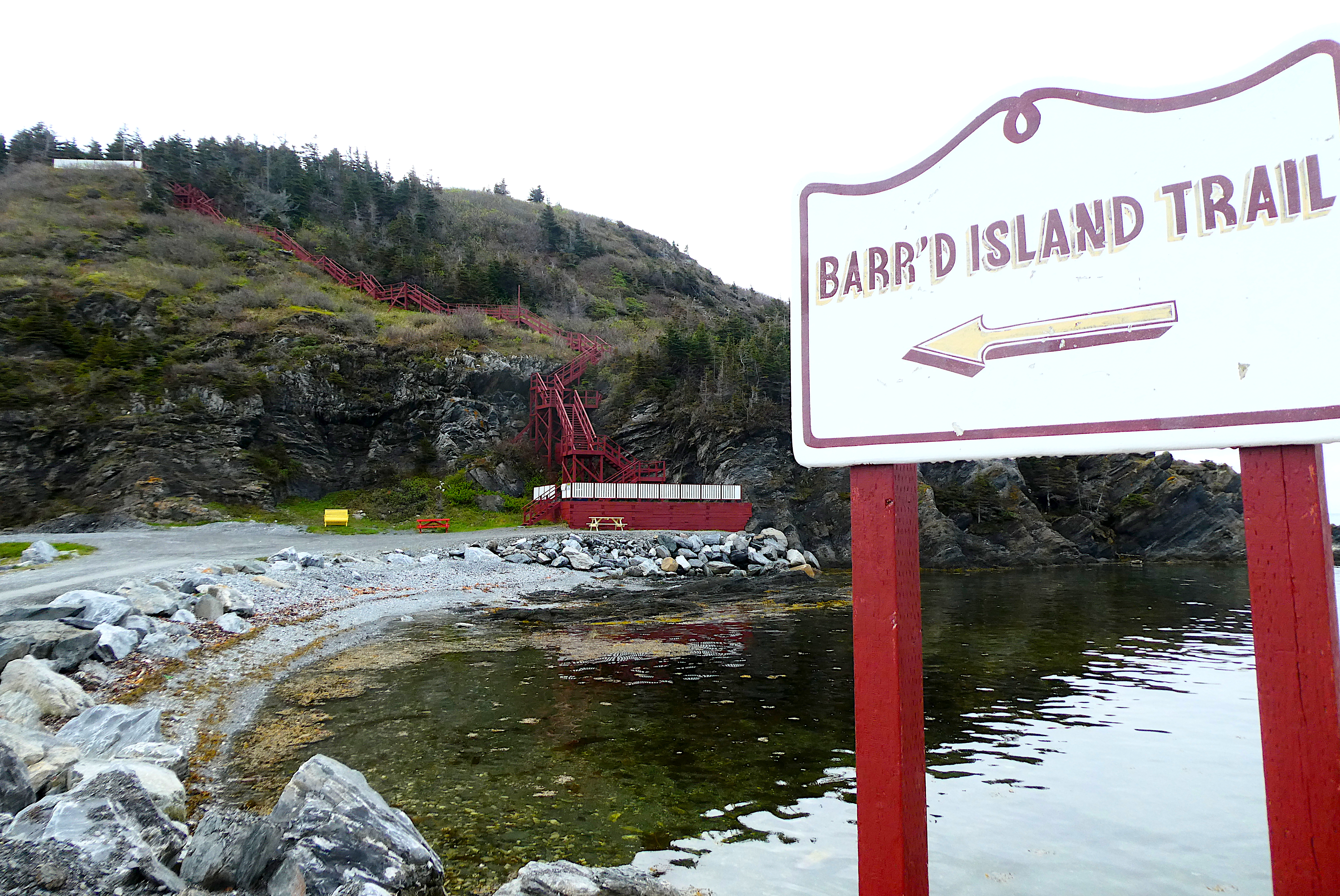
No icebergs or whales, but a great view none the less.

We then made our way back up the Arm.

We stopped at the Green Moose Interpretative Center in Roddickton-Bide Arm, the self-proclaimed “Moose Capital of the World”. It’s actually a room in the town hall that addresses the history of Roddickton and the dilemma of Newfoundland’s moose. The town, an inport, was made by Dr. Grenfell to help alleviate poverty and break the hold of the “credit system” in which the fishermen were always in debt to the merchants who financed their fishing, bought their fish, but rarely paid them enough to settle their debts. Grenfell named the town and the saw mill he founded there for his friend and supporter Dr. Thomas Roderick and used its lumber in building the Grenfell health mission buildings.
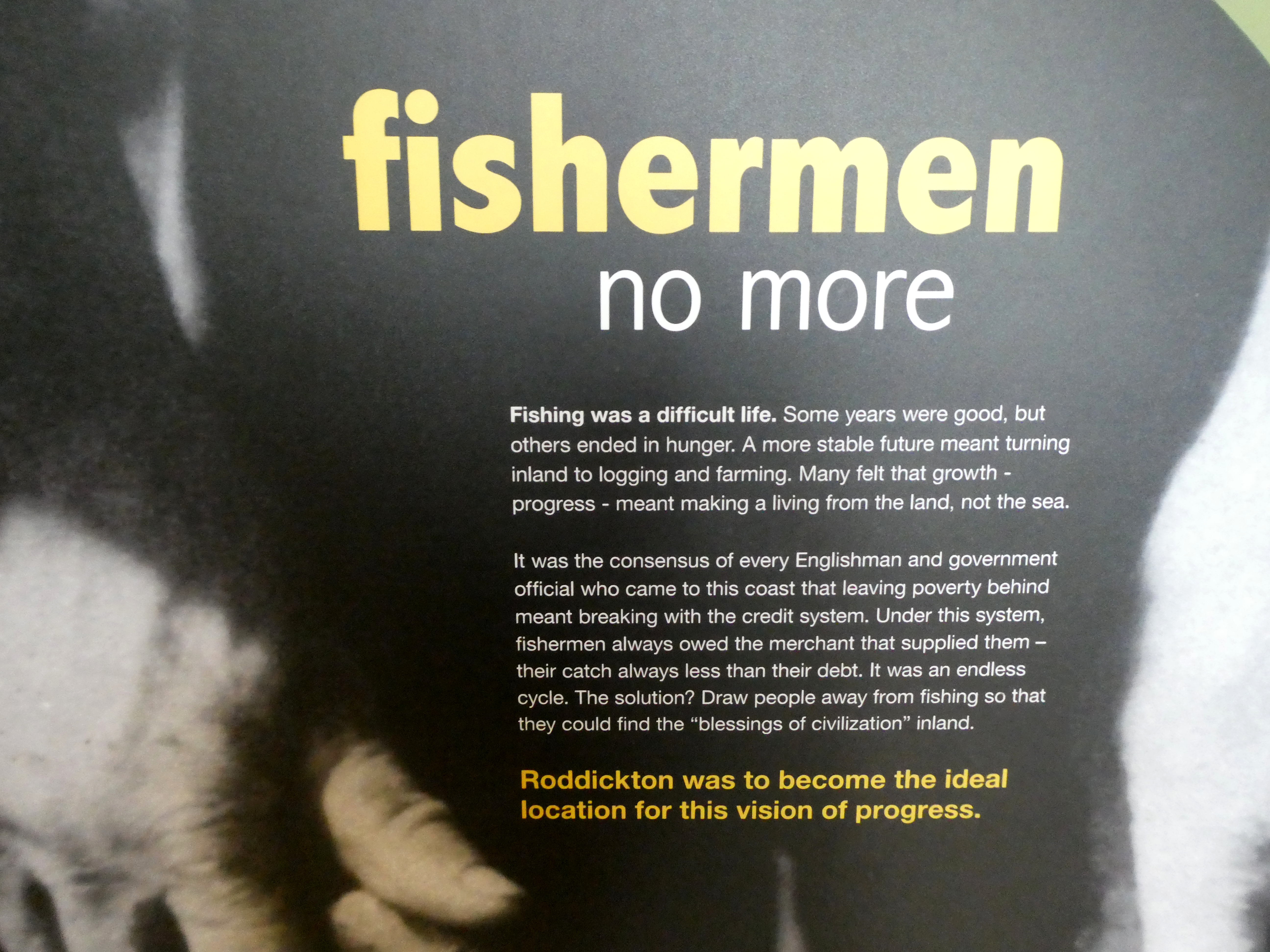
It wasn’t always easy even then, since the mill burned down several times and the men weren’t always happy with wage labor and would often return to the sea when the fishing was good.
The moose was introduced to Newfoundland a couple of times about a hundred years ago in an attempt to augment the food supply. It has its value as food and tourism, but it also has its downside as it damages the native forests and its a road hazard being involved in 700-800 vehicle accidents a year. There are an estimated 125,000 to 150,000 moose in Newfoundland, the highest density in North America.

Roddickton-Bide Arm has some interesting notes on its website about its history and the resettlement era.
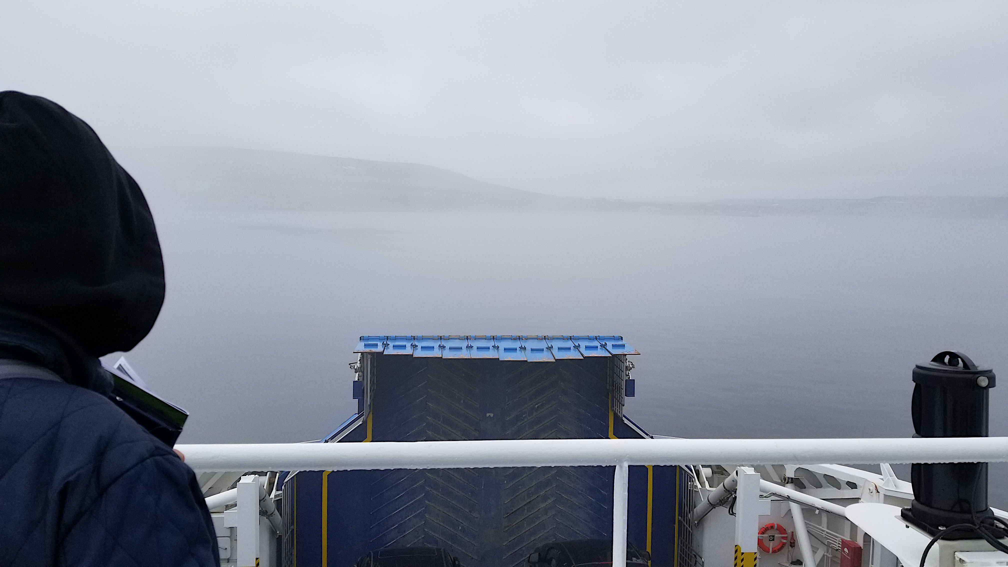
After lunch, we drove back up the 433 to the 432 and west across the Great Northern Peninsula to the Viking Trail and north to St. Barbe and onto the ferry to Labrador.

Two hours later, and a somewhat foggy passage, we disembarked the ferry in Blanc-Sabin, Quebec.
We then drove East into Labrador and on to Pinware Provincial Park in for the night.

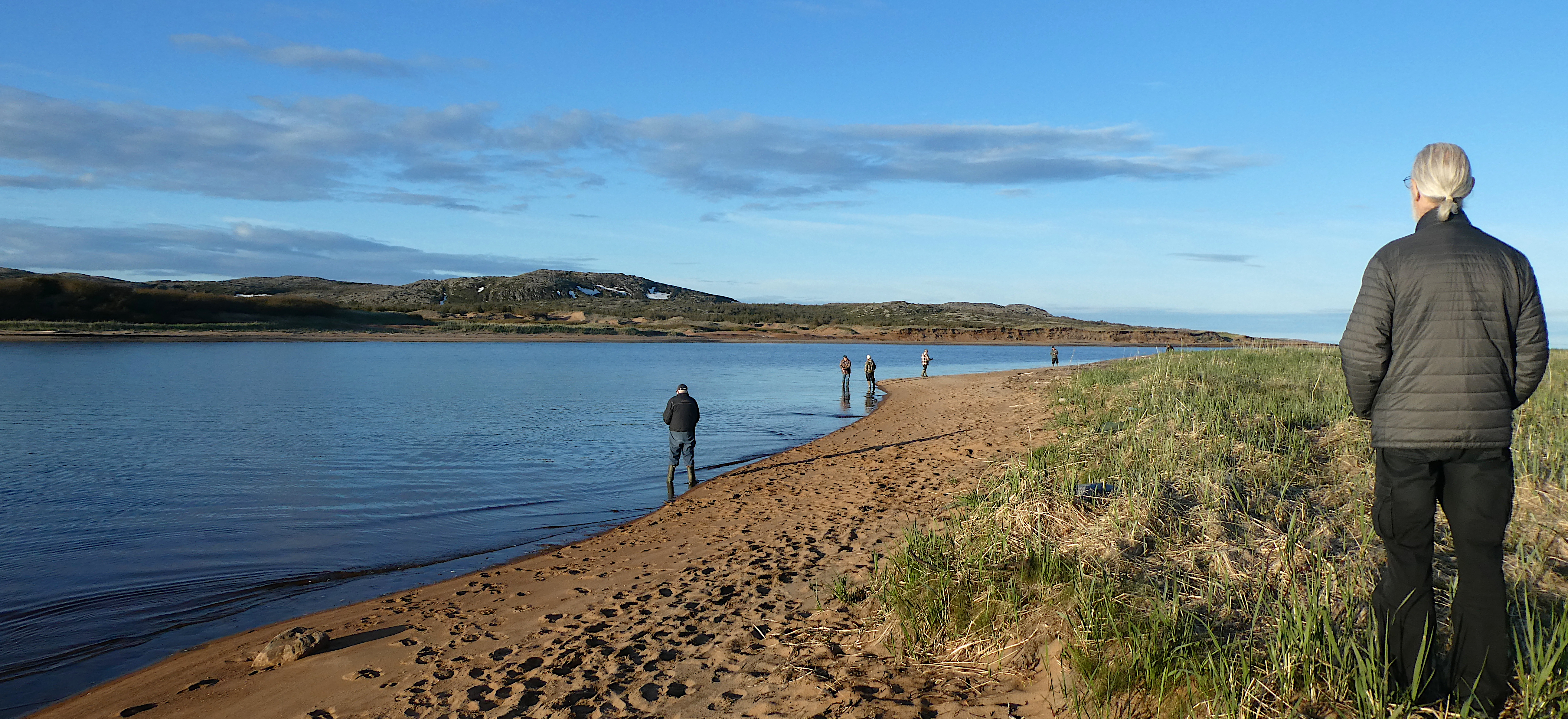
Fishing laws are complicated in Newfoundland, different for Nufies and visitors as well as different types of fish and different places. Since a license is required to fish in fresh water but not in salt water, the fishermen at Pinware cut were just too the sea-side of the demarcation.
Some more information courtesy of Parks Canada:
The bedrock in the area around Pinware River Provincial Park is composed of a variety of very old and somewhat deformed granites. A sample of granite obtained from a small, roadside quarry near the entrance to the park has been dated at 1,466 million years old. These old granites form part of the Grenville Province which also includes rocks as young as 955 million years old. The Grenville Province extends across Southern Labrador and into Southern Quebec and Ontario and is the youngest geological province in the Canadian Shield. Boreal forest is the main vegetation around Pinware Park. It is a dense coniferous forest, broken by outcrops of ancient rocks shaped and deposited by the great icesheets that spawned across the region. Bogs, pure clean lakes and ponds, and crystal-clear rivers and streams contribute to the landscape. A variety of deciduous trees, such as the Paper Birch and Balsam Poplar, have found a niche among the conifers. Many species of plants grow in the park as well as many different and tasty berries. Wildlife includes many different species of insects, birds, and mammals both small and large. The park is adjacent to the Strait of Belle Isle where whales and seabirds are plentiful. Within the park a visitor may awake to the haunting cry of a loon and see other animals such as squirrels. Visitors will notice that these faunal assemblages are different from the island of Newfoundland.
Artifacts discovered adjacent to the town of Pinware indicate, from radiocarbon dating, that Pinware Hill is one of the earliest Palaeo Indian archaeological sites in the province, dating back nearly 9000 years. Many different Aboriginal cultures lived in the area of Pinware from time to time. The longest time of habitation was probably during the Maritime Archaic period. A burial monument near L’anse Amour, just south of Pinware, dating to 7500 years ago, is attributed to the Maritime Archaic and is the oldest such mound in North America, maybe even the world. Later, Pre-Dorset Palaeo-Eskimos used the rich marine resources found at Pinware. They were followed by the Groswater Palaeo-Eskimos and then the Dorset Paleo-Eskimo cultures who also utilized the rich marine resources while continuing their migration southward to the Island of Newfoundland. Europeans were attracted to the area in the 16th century for the rich marine resources just as the Indigenous peoples were. The Basque who operated one of the New World’s earliest whaling stations at Red Bay, more than likely travelled to Pinware for various reasons, one of which may have been firewood. French fishermen were visiting the area by the 1600s. A trading post was opened and the seal hunt and salmon fishery were integral to its operation. The first year-round European settlers were probably Irish immigrants who made their way to Pinware via Carbonear in the late 1700s.