Friday started cold, sunny, and windy at Grand Bay West Trailhead on Kyle Lane in Port aux Basques, NL. Being a beach and trail head, there are both changing rooms (still locked) and washrooms.
After breakfast, we went for a walk on the beach, then drove around Port aux Basques at bit to enjoy it in the sunlight.
 Similar to Alaska, a significant portion of Newfoundland is inaccessible by road. Not only is the coast long, rocky, and deeply cut by many bays, there are significant mountain ranges with peaks up to 2670 feet. (Another time we’ll take a brief look at both the overall geology of the island, and also the “resettlement” that occurred after Newfoundland and Labrador joined Canada to try to deal with the sparse settlement and isolated communities.)
You can think of Newfoundland as a big triangle with St. John’s on the southeast, Channel-Port aux Basques on the southwest, and St. Anthony way north in between. Each side of the triangle is about 300 miles as the cross flies. The main highway is the Trans-Canada, Route 1, which runs from St. John’s, NL to Vancouver, BC. The Newfoundland portion makes a big loop to the northwest from St. John’s part-way up the northeast side of the triangle then turns to the southwest and ends at the ferry terminal at Channel-Port aux Basques. The Viking Trail runs along the west coast from the Trans-Canada north to St. Anthony.

That gets us back to what we did today. We drove the Trans-Canada out of Channel-Port aux Basques back to Cheeseman Provincial Park where there was a different attendant who let us take showers for free. Enjoyed the showers very much. Good layout except no electricity for hair dryer.
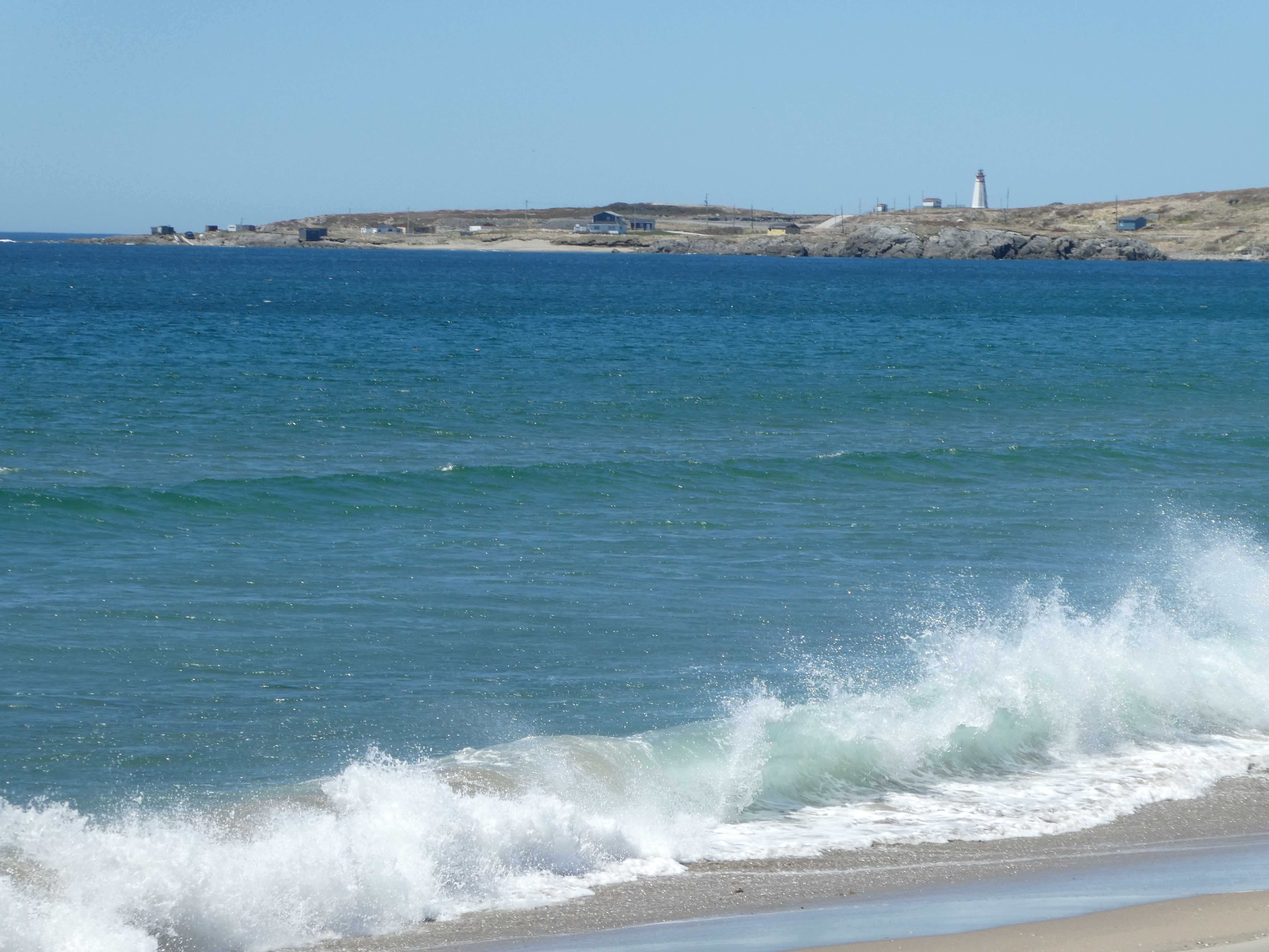
After our showers we drove across a narrow bridge and over to the park’s beach. From there we could see the Cape Ray Lighthouse.
The sand was too soft to really walk easily on so we returned to our coach by a pond and had lunch.
Then it was back to the Trans-Canada. We checked out the Wreckhouse pullout which is in an area where the winds off the Gulf of St. Lawrence have been known to blow trains off their tracks. Trucks can wait in the pullout for the wind to abate. The pullout is marked as a boondocking spot in some of our apps.
Along the way there were streams tumbling over the rocks on their way to the Gulf.

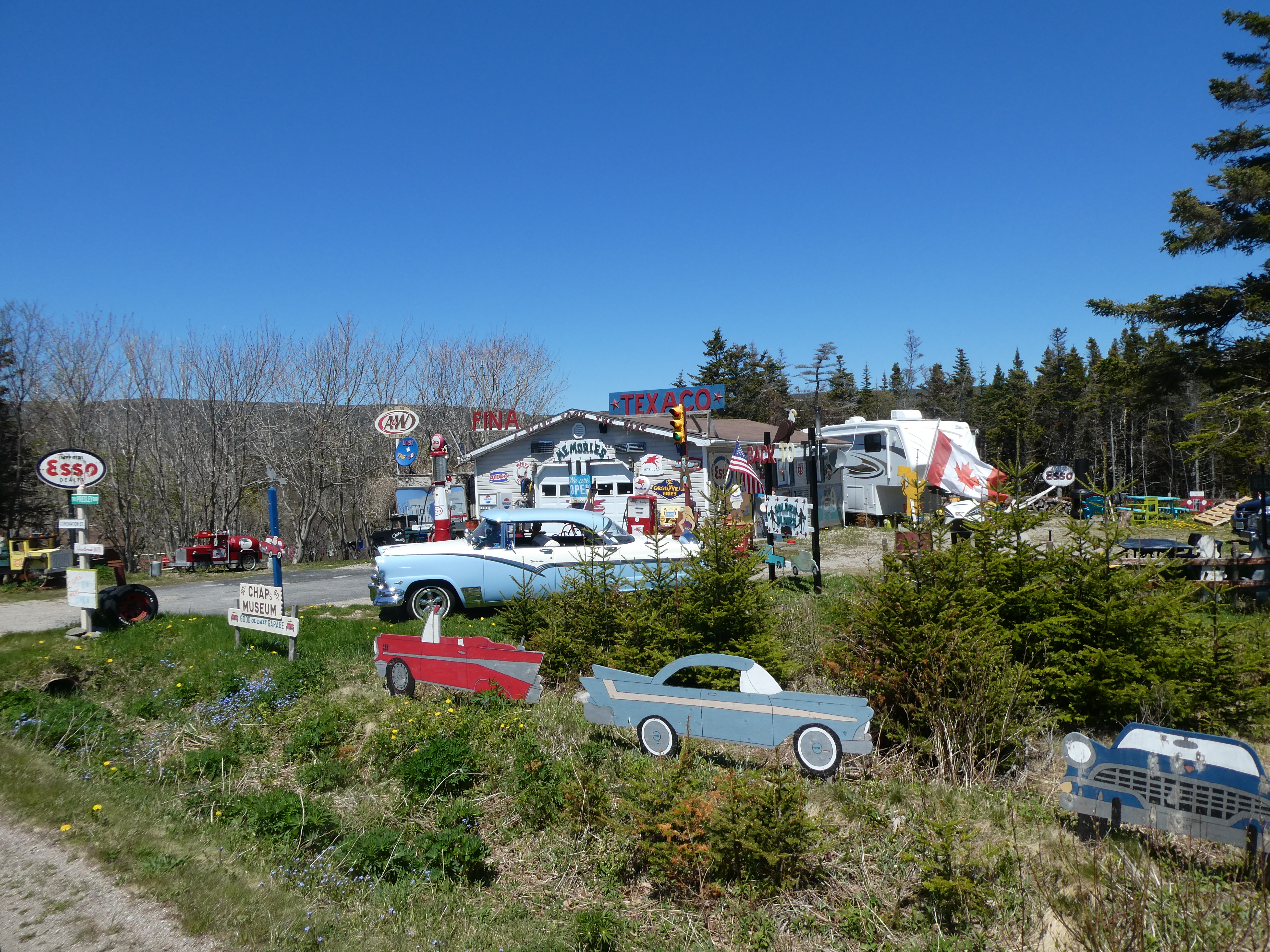
You can also see some crazy things along the road; like Chap’s Museum.
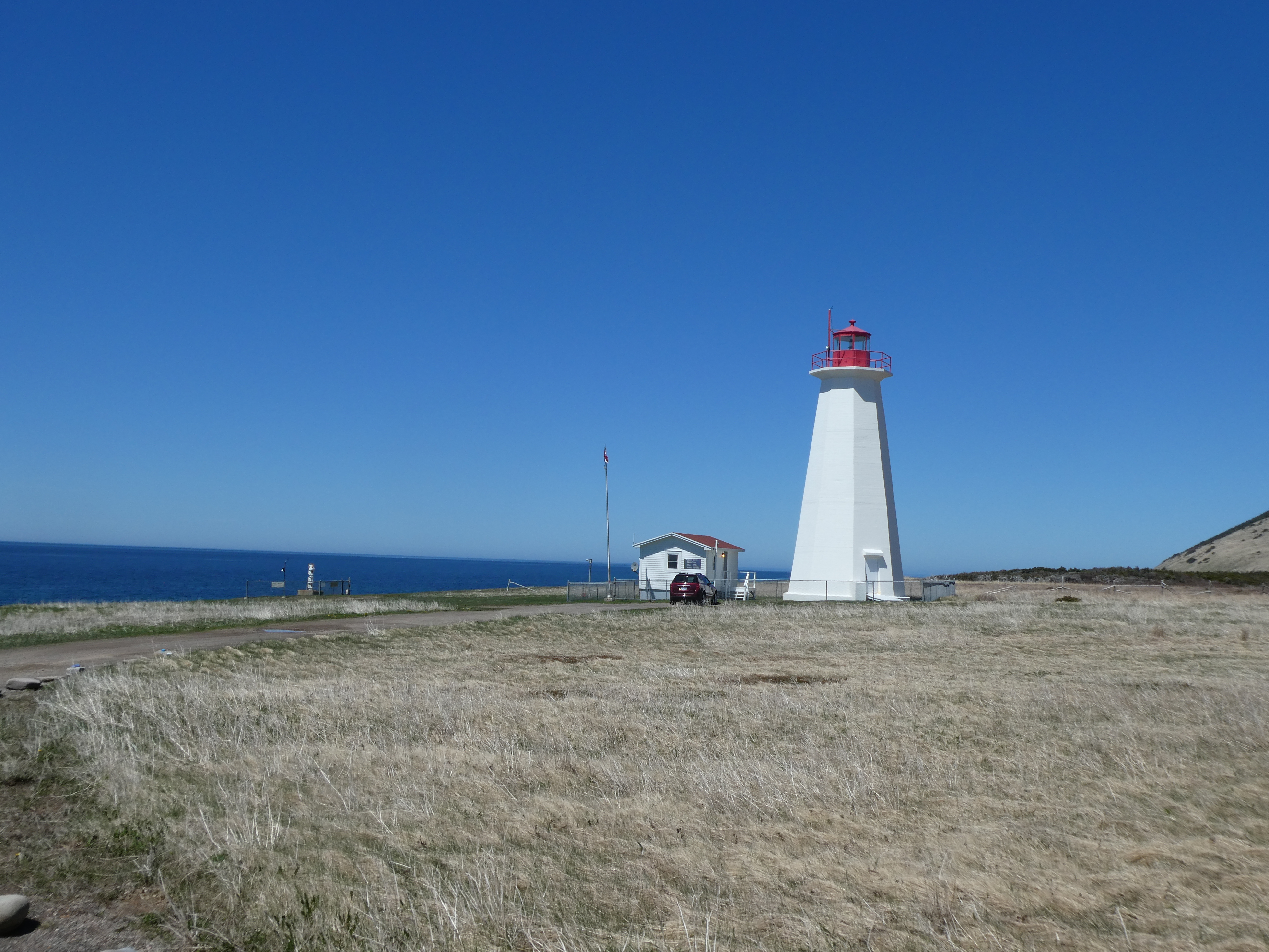
We turned off Rt. 1 again to go on Route 407 into the Codroy Valley, then Route 406 to Cape Anguilla, which is the most westerly point in Newfoundland.
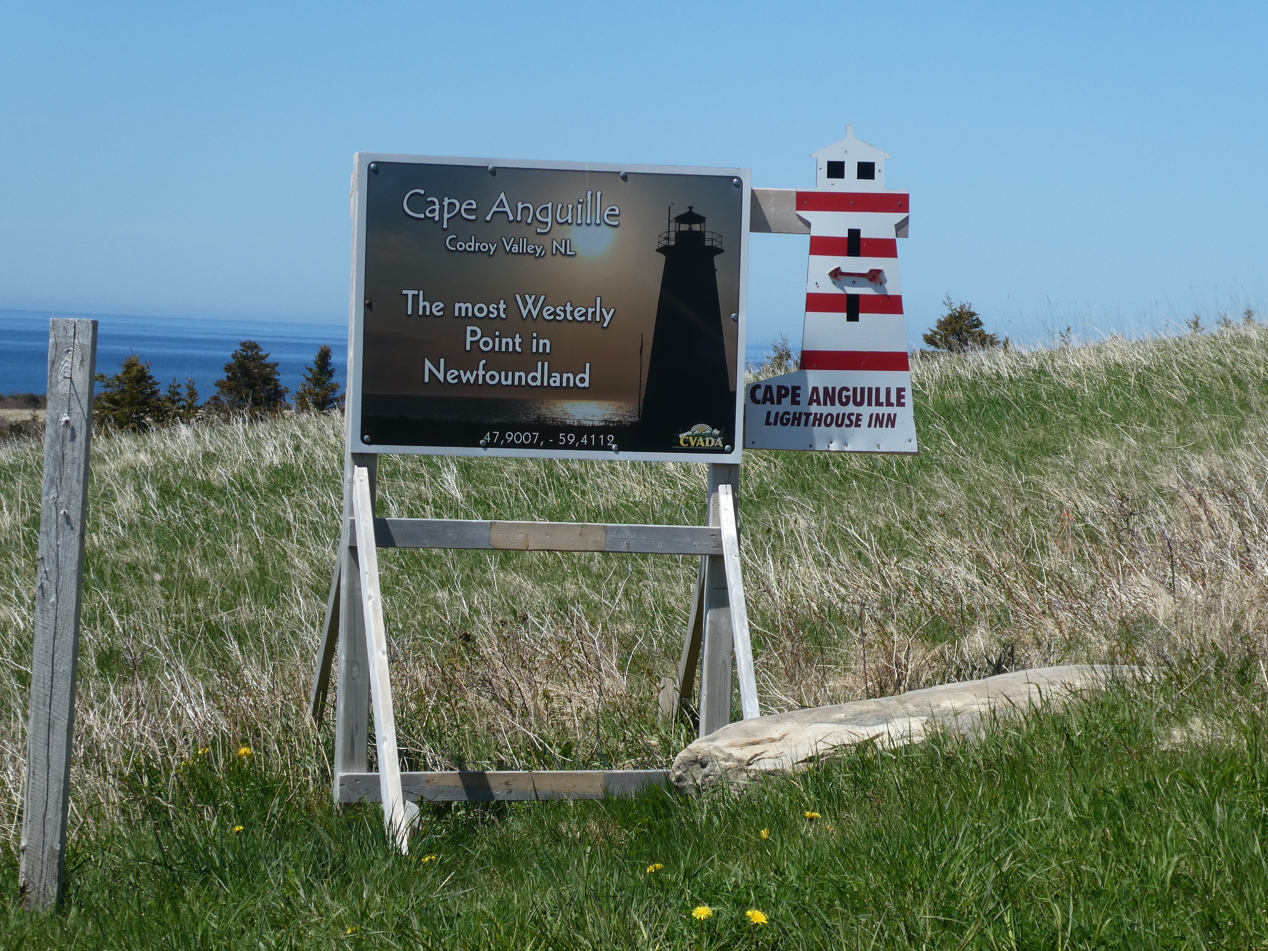
And, no surprise, it has a lighthouse.
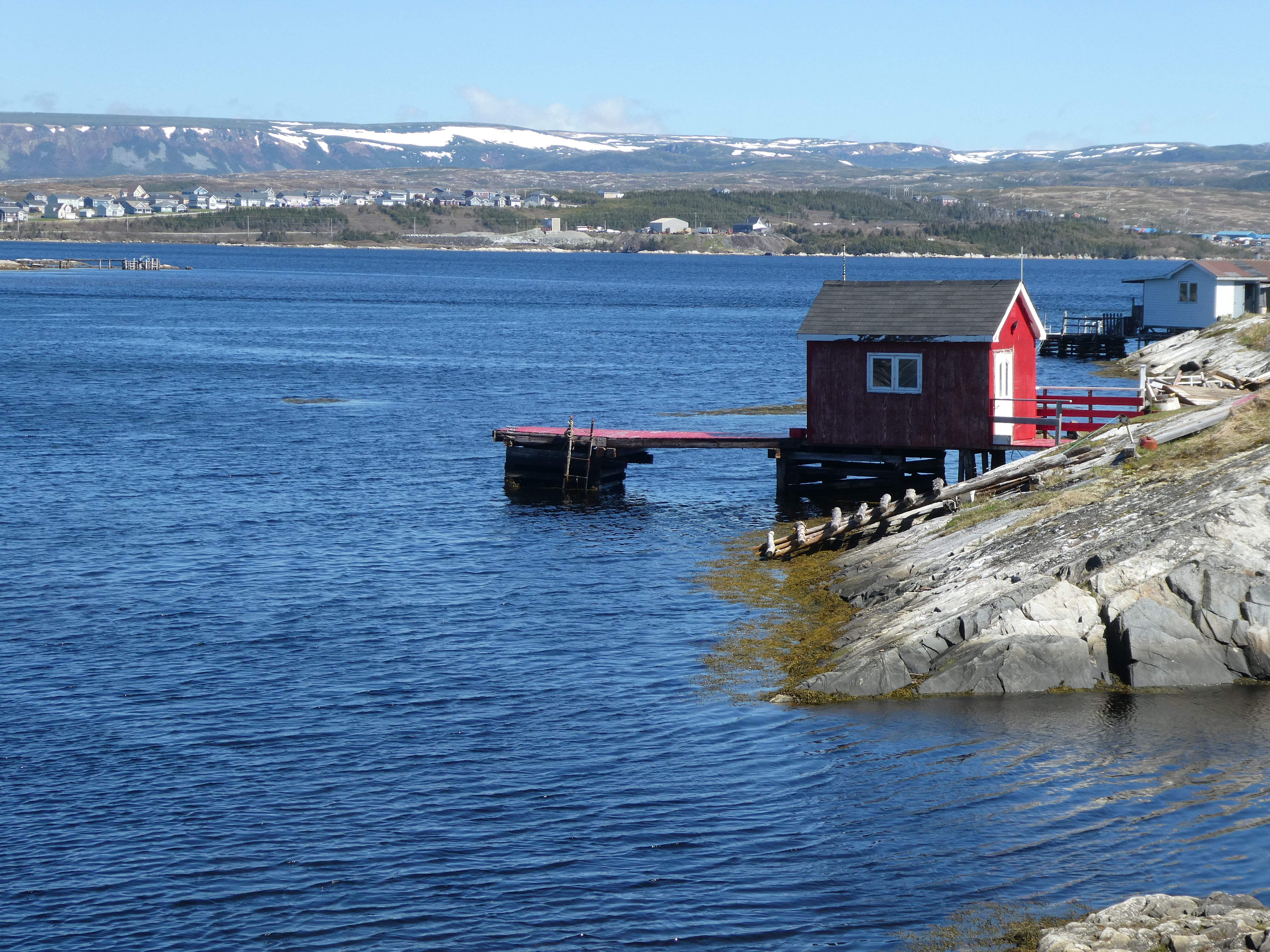
Then back to Route 1. Saw a blue heron, lots of black spruce and rivers and streams. Looking for a good boondocking spot, we headed down the Route 404 loop and found a little pullover on a road to and above a small fishing port on a river in St. David’s on St. George’s Bay. Sat there a bit just looking at the view.
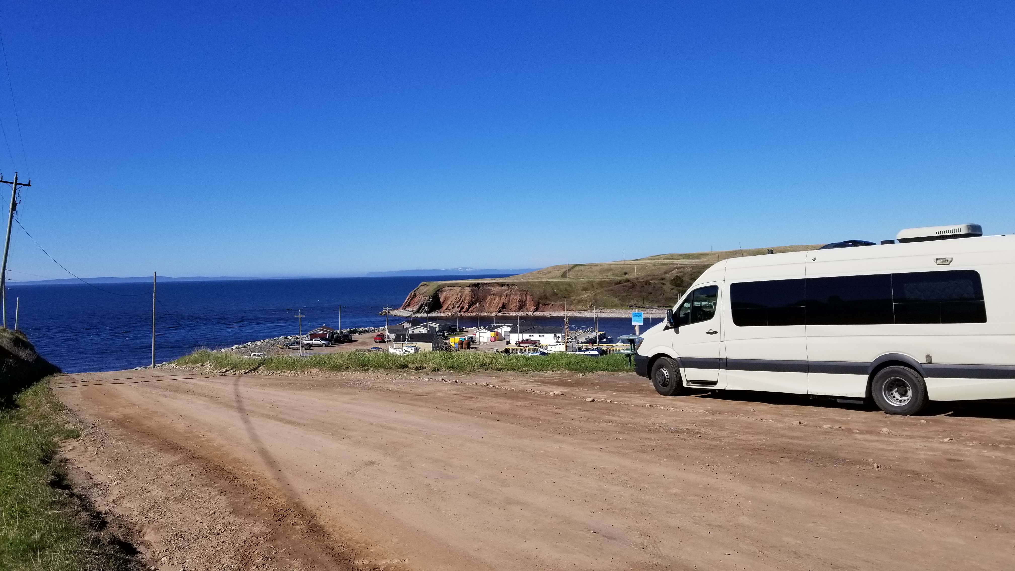
A car pulled up behind us and the old guy got out and come over to chat and tell us about the area. When he left it was past dinner time so we made a quick dinner of brats and sauerkraut. The old guy came over again and trapped on the drivers window and we chatted again. He left and we decided to try for the place Hanson had seen on the way in at the other side of the cliff by a cemetery.
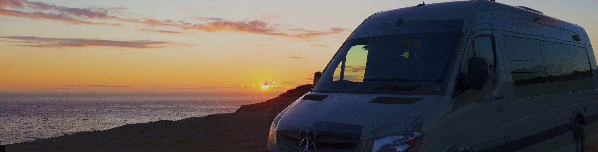
We turned around and drove up a dirt road that had huge potholes and ruts. Scraped the running boards a bit when we sank down into a hole instead of straddling it but luckily no harm done. The view from the top was spectacular and we loved the sense of wild camping it gave us to be up there. We watched the sunset around 9:30, had our brownies and got ready for bed. We were all alone up there.


